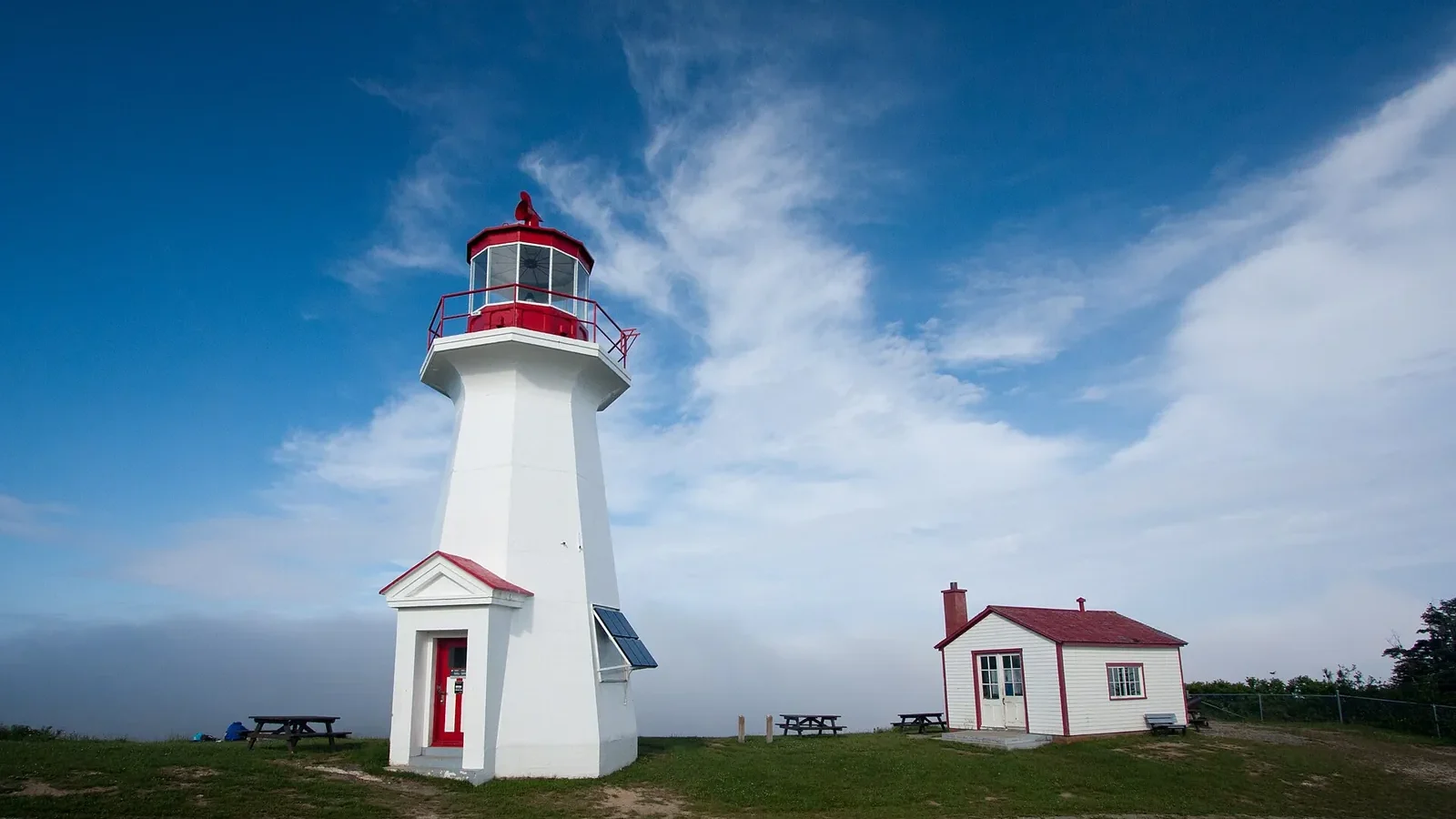
The Gaspé Peninsula (la Gaspésie, as Quebecers call it) is eastern Québec’s great road trip: a loop of about 885 km (550 miles) on Route 132, past sea cliffs, lighthouses, fishing villages and mountains that drop straight into the Gulf of St. Lawrence. Seven days is the sweet spot for a first visit — enough to see Percé Rock, hike in Forillon National Park and head up into the Chic-Chocs without spending every day behind the wheel.
Our route starts in Sainte-Flavie, the traditional gateway to the peninsula, and runs clockwise: the north shore first, then the tip (Forillon, Gaspé, Percé), then Chaleur Bay and back through the Matapedia Valley.
At a glance
- Loop distance: about 885 km (550 mi) from Sainte-Flavie and back, before detours.
- Ideal length: 7 days minimum; 10 days if you like to linger.
- Best time: late June to mid-September; late September for fall colours (with fewer services open).
- Parks: Parc national de la Gaspésie and Parc national de l’Île-Bonaventure-et-du-Rocher-Percé (run by Sépaq, Québec’s park agency) and Forillon National Park (Parks Canada).
- Book early for summer: rooms in Percé and Gaspé, the Gîte du Mont-Albert and park campgrounds.
In this guide
- Getting there
- The itinerary at a glance
- Day 1: Reford Gardens and the coast to Sainte-Anne-des-Monts
- Day 2: Parc national de la Gaspésie and the Chic-Chocs
- Day 3: The north shore to Forillon
- Day 4: Forillon National Park and Gaspé
- Day 5: Percé, the Rock and the Geopark
- Day 6: Bonaventure Island and Chaleur Bay
- Day 7: Miguasha and the Matapedia Valley
- Where to stay
- When to go
- Variations: 5 days, 10 days or more
- Frequently asked questions
- Sources
Getting there
From Montréal, Sainte-Flavie is roughly a 6-hour drive along Highway 20; from Québec City, about 3.5 hours. Coming from Ontario, add the drive to Montréal (around 5.5 hours from Toronto). From New Brunswick or Maine, you can reach Rivière-du-Loup via Highway 85 from Edmundston, or cross the bridge from Campbellton (NB) to Pointe-à-la-Croix and simply run the loop in reverse, starting with Chaleur Bay.
A car is essential: distances are long and public transport is very limited. Top up the tank when you can in the quieter stretches of the north shore and the Matapedia Valley.
Language
The Gaspé is overwhelmingly French-speaking. You’ll get by in English in hotels, parks and most tourist businesses, especially along Chaleur Bay, where there are long-established English-speaking communities, but a few words of French go a long way in small villages.
The itinerary at a glance
Distances are rough guides for the main drive of each day; the coastline is full of photo stops, so plan extra time.
| Day | Route | Approx. distance | Highlights |
|---|---|---|---|
| 1 | Sainte-Flavie → Sainte-Anne-des-Monts | ≈ 160 km (100 mi) | Reford Gardens, Matane, Cap-Chat |
| 2 | Parc national de la Gaspésie | short drives | Lac aux Américains, Mont Ernest-Laforce, Sainte-Anne falls |
| 3 | Sainte-Anne-des-Monts → Forillon | ≈ 220 km (135 mi) | La Martre lighthouse, Mont-Saint-Pierre, Cap-des-Rosiers |
| 4 | Forillon and Gaspé | short drives | Les Graves trail to Cap-Gaspé, Grande-Grave |
| 5 | Gaspé → Percé | ≈ 65 km (40 mi) | Percé Rock, Mont Sainte-Anne, the Geopark |
| 6 | Percé → Carleton-sur-Mer | ≈ 190 km (120 mi) | Bonaventure Island, Chaleur Bay |
| 7 | Carleton-sur-Mer → Sainte-Flavie | ≈ 250 km (155 mi) | Miguasha, the Matapedia Valley |
Day 1: Reford Gardens and the coast to Sainte-Anne-des-Monts
Your first stop is just past Sainte-Flavie in Grand-Métis: the Reford Gardens (Jardins de Métis), one of Canada’s best-known gardens, famous for its blue Himalayan poppies and its International Garden Festival. Allow an hour and a half to two hours.
From there, Route 132 hugs a St. Lawrence so wide it looks like the open sea. Break for lunch in Matane (known for its northern shrimp), then pull over in Cap-Chat, home to a giant vertical-axis wind turbine that has become a local landmark. Spend the night in Sainte-Anne-des-Monts, the gateway to the mountains. With kids, Exploramer, a museum about the marine life of the St. Lawrence, is a good rainy-day option.
Day 2: Parc national de la Gaspésie and the Chic-Chocs
Take Route 299 inland into the Parc national de la Gaspésie. This is the realm of the Chic-Choc and McGerrigle mountains, with several peaks above 1,000 m — including Mont Jacques-Cartier (1,270 m), the highest summit in southern Québec — and the last caribou herd south of the St. Lawrence River.
Good hikes for a full day (round-trip distances from Sépaq):
- La chute Sainte-Anne (1.7 km): short and easy, a perfect warm-up.
- Lac aux Américains (2.6 km): a glacial lake tucked below sheer walls, lovely in late-day light.
- Mont Ernest-Laforce (4.6 km): known for moose sightings.
- Mont Albert north side (11.6 km, 860 m of climbing): for strong hikers, with a rare alpine plateau.
Mont Jacques-Cartier and the caribou
The Mont Jacques-Cartier trail, where you may spot caribou, is tightly managed to protect this endangered herd: normally open July 1 to September 30, hiking only between 10 a.m. and 4 p.m., access only by shuttle from the Jacques-Cartier campground, and no going off-trail. Sépaq can close sectors depending on where the caribou are, so check the trail status on sepaq.com before you go.
Stay in the heart of the mountains at the Gîte du Mont-Albert or a park campground, or drive back down to Sainte-Anne-des-Monts.
Day 3: The north shore to Forillon
This is your scenic-drive day. Between Sainte-Anne-des-Monts and Rivière-au-Renard, Route 132 squeezes between mountains and sea, dipping into coves and tiny villages. Worth a stop:
- La Martre and its red wooden lighthouse, one of the most photographed on the peninsula.
- Mont-Saint-Pierre, a hang-gliding hotspot nestled at the back of a dramatic bay.
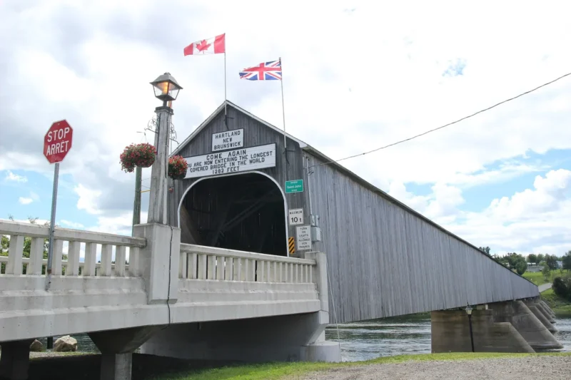
- Grande-Vallée and its covered bridge.
- Cap-des-Rosiers, home to the tallest lighthouse in Canada.
Overnight near the north entrance of Forillon (Cap-des-Rosiers, L’Anse-au-Griffon) or in Gaspé.
Day 4: Forillon National Park and Gaspé
Forillon National Park, run by Parks Canada, protects the very tip of the peninsula: limestone cliffs, forests, pebble beaches and plenty of wildlife — seals, seabirds, black bears and, offshore in season, whales.
The must-do hike is Les Graves, which ends at Cap-Gaspé, “Land’s End”, where a small lighthouse sits above a cliff about 95 m high. According to Parks Canada, it’s 8 km return from L’Anse-aux-Amérindiens (2–3 hours) or 15.2 km return from Grande-Grave (4–5 hours). Along the way, the Grande-Grave heritage site tells the story of the cod-fishing families who once lived here.
Other options: the lookout tower on Mont Saint-Alban, the seals near Cap-Bon-Ami and a whale-watching cruise from the Grande-Grave area or Gaspé.
In the late afternoon, explore the town of Gaspé, where Jacques Cartier planted a cross in 1534. The Musée de la Gaspésie and the Gespeg Mi’gmaq interpretation site give context on the region’s history, before and after European contact.
Parks Canada or Sépaq?
Forillon is a Parks Canada site, so the Parks Canada Discovery Pass works there. Québec’s provincial “national parks” (Gaspésie, Bonaventure Island, Miguasha) are run by Sépaq, which charges its own daily fees and sells its own annual pass. Do the math based on how many days you’ll spend in each network.
Day 5: Percé, the Rock and the Geopark
Percé is about 65 km from Gaspé. Percé Rock, a massive limestone block pierced by the sea, is the very image of the Gaspé. To see it from every angle:
- Hike or take the seasonal shuttle up Mont Sainte-Anne for a bird’s-eye view of the village, the Rock and Bonaventure Island.
- Visit the Percé UNESCO Global Geopark, designated in 2018 for its exceptional geology; its glass platform hanging over the void is a highlight.
- Walk the beach and wharf at sunset.
Safety at the Rock
Rockfalls happen regularly. Respect the signs and closed areas, and stay away from the base of the Rock.
Spend the night in Percé so you can catch the first boat to Bonaventure Island the next morning.
Day 6: Bonaventure Island and Chaleur Bay
In the morning, board a boat at Percé’s wharf for Parc national de l’Île-Bonaventure-et-du-Rocher-Percé. Cruises usually circle the Rock before dropping visitors on the island, where forest trails lead to one of the largest northern gannet colonies in the world. Tens of thousands of nesting birds — the sight, the sound and, yes, the smell — are unforgettable. The park season runs roughly from late May to mid-October, and the gannets are mostly present from June to September.
In the afternoon, head southwest along Chaleur Bay, gentler and warmer than the north shore:
- Bonaventure: the Bioparc de la Gaspésie (regional wildlife) and the Musée acadien du Québec — Acadian culture is part of the story here too.
- New Richmond and its beaches.
- Carleton-sur-Mer, your stop for the night: drive or hike up Mont Saint-Joseph for a view across the bay to New Brunswick.
Day 7: Miguasha and the Matapedia Valley
Before leaving the bay, stop at Parc national de Miguasha, a UNESCO World Heritage Site since 1999 for its Devonian fish fossils, a key chapter in the story of how vertebrates moved onto land.
Then follow Route 132 up the Matapedia Valley, past salmon rivers, covered bridges and farm villages, to Amqui and back to Sainte-Flavie. Heading to the Maritimes instead? Cross at Pointe-à-la-Croix to Campbellton, New Brunswick.
Where to stay
Changing hotels every night gets tiring. With these four bases you’ll only move three or four times:
| Base | Nights | Why |
|---|---|---|
| Sainte-Anne-des-Monts or the Gaspésie park | 2 | Direct access to the Chic-Chocs; Gîte du Mont-Albert and Sépaq campgrounds |
| Gaspé or the Forillon area | 1–2 | Forillon on your doorstep, full services in Gaspé |
| Percé | 1–2 | First boat to Bonaventure Island, sunsets |
| Carleton-sur-Mer or Bonaventure | 1 | Chaleur Bay beaches, easy start for Miguasha |
In July and August, book months ahead, especially in Percé. Outside the season, many places close, so check opening dates.
When to go
- Late June to early September: everything is open and days are long, but it’s high season. Evenings stay cool on the coast, even in July.
- September: fewer people and beautiful light; some activities start to wind down.
- Late September to early October: fall colours in the Chic-Chocs and Matapedia. High mountain trails close progressively (some in the Gaspésie park close as early as October 1) and services thin out.
- Winter: a renowned backcountry ski and snowshoe destination, but it’s a different trip altogether.
- Remarkably varied scenery on one loop: river, mountains, cliffs, bay.
- An easy road to follow, with small, welcoming villages.
- Three outstanding parks in a single week.
- Long distances: expect several 3–4 hour driving days.
- Short tourist season, with accommodation snapped up in July and August.
- Changeable weather and frequent coastal fog.
Variations: 5 days, 10 days or more
- In 5 days: focus on the tip. Day 1 Sainte-Flavie → Sainte-Anne-des-Monts; day 2 coast → Forillon; day 3 Forillon; day 4 Percé and Bonaventure Island; day 5 back via the Matapedia. You’ll skip the Chic-Chocs or Chaleur Bay.
- In 10 days: add a second hiking day in the Gaspésie park, a free day in Percé (kayaking, or snorkelling with seals with local operators when available) and a night in Carleton-sur-Mer.
- With New Brunswick: Chaleur Bay leads naturally to the Acadian Peninsula (Caraquet, Lamèque, Miscou). See our guide to things to do in New Brunswick.
Frequently asked questions
How many days do you need for the Gaspé Peninsula?
Seven days is a comfortable minimum for the roughly 885 km loop and its highlights (Chic-Chocs, Forillon, Percé, Bonaventure Island). With 10 days you can hike more and slow down.
Which direction should I drive around the Gaspé?
The classic route runs clockwise from Sainte-Flavie along the north shore to Forillon, then Percé and Chaleur Bay. If you arrive from New Brunswick via Campbellton, just do the loop the other way. Both work well.
When is the best time to visit the Gaspé Peninsula?
Late June to mid-September, when all services, cruises and trails are open. Late September brings fall colours, but with seasonal closures.
Can you see whales in the Gaspé?
Yes. Whale-watching cruises leave from the Forillon/Gaspé area and from Percé, usually from June to October. You may also spot whales from shore, though there’s no guarantee.
Do I need to speak French in the Gaspé?
No, but it helps. The region is mostly French-speaking; English is widely understood in parks, hotels and tourist businesses, and Chaleur Bay has historic English-speaking communities.
Sources
- Bonjour Québec, “Le tour de la Gaspésie”: bonjourquebec.com
- Tourisme Gaspésie (official regional tourism site): tourisme-gaspesie.com
- Sépaq, Parc national de la Gaspésie (trail status, Mont Jacques-Cartier, caribou): sepaq.com/pq/gas
- Sépaq, Parc national de l’Île-Bonaventure-et-du-Rocher-Percé: sepaq.com/pq/bon
- Parks Canada, Forillon National Park (hiking, Les Graves trail): parks.canada.ca/pn-np/qc/forillon
- Canadian Commission for UNESCO, Percé UNESCO Global Geopark (2018): en.ccunesco.ca
- UNESCO, Miguasha National Park (World Heritage, 1999): whc.unesco.org/en/list/686
.jpg)